Image: Shutterstock
n/a
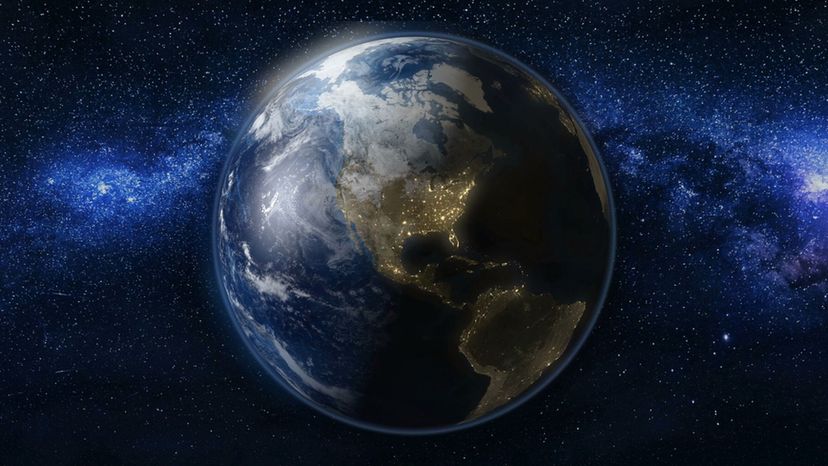
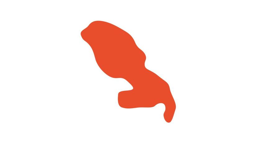
Which country's outline is shown in this image?
Guatemala
Cuba
Greenland
Greenland is the largest island in the world but it is still about nine times smaller than the island-continent of Australia. Formally known as an autonomous constituent country within the Kingdom of Denmark, Greenland is the least-populated country in the world.
Antigua and Barbuda
n/a
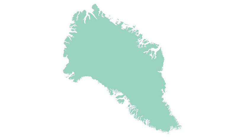
Which country's outline is shown in this image?
United States of America
In terms of area, the largest of the 50 U.S. states is Alaska. It is about 450 times bigger than the smallest state, Rhode Island. In terms of population, however, Rhode Island's is almost one and a half times that of Alaska's.
Saint Lucia
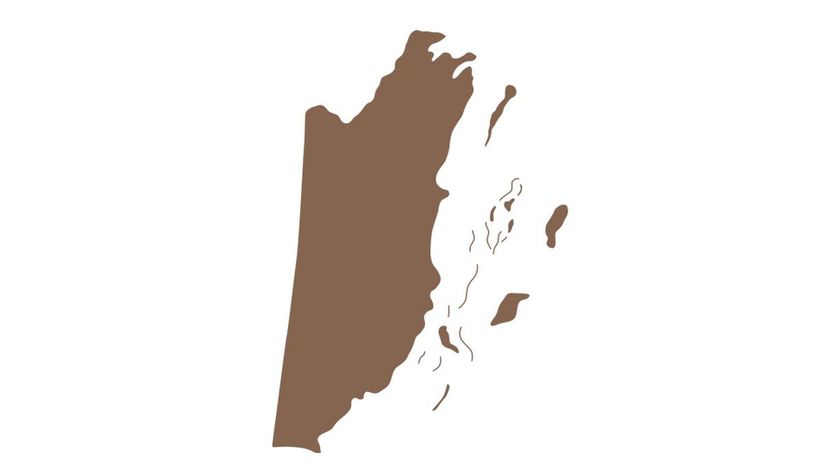
Belize
Montserrat
Shutterstock
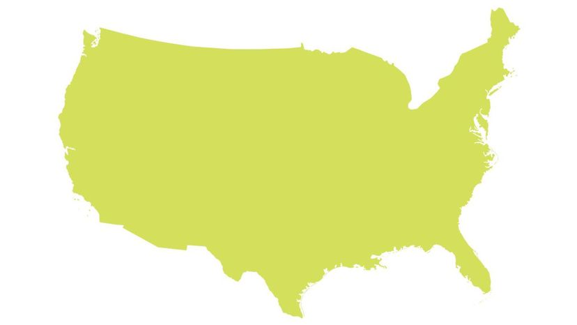
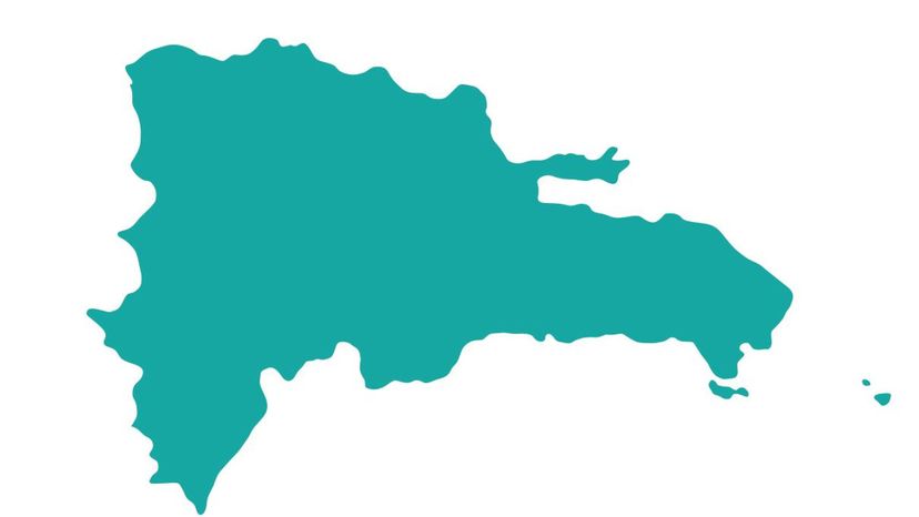
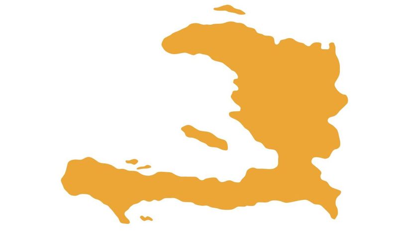
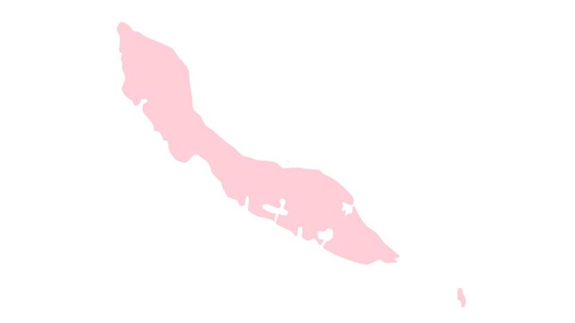
Which country's outline is shown in this image?
Sint Maarten
Dominican Republic
Often referred to as the D.R., the Dominican Republic is the second-largest country in the Caribbean, after Cuba. It takes up five-eighths of the island of Hispaniola which it shares with Haiti.
Ecuador
Panama
Advertisement
Shutterstock
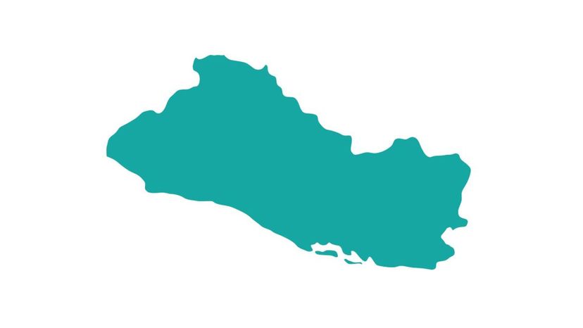
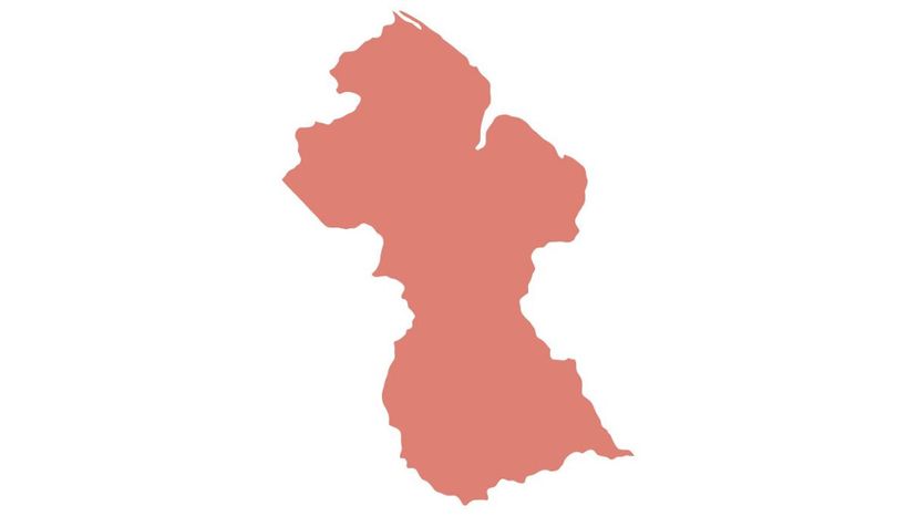
Which country's outline is shown in this image?
Barbados
The flag of Barbados features a black, broken trident of Poseidon. The fact that the trident's staff is broken is meant to symbolize the country's break from colonial rule when it became independent on November 30, 1966.
El Salvador
Guyana
Guadeloupe
Shutterstock
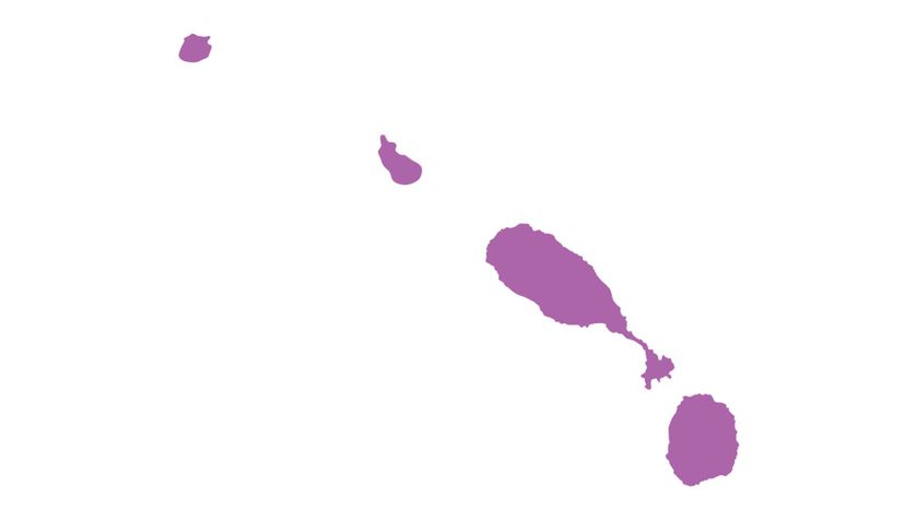
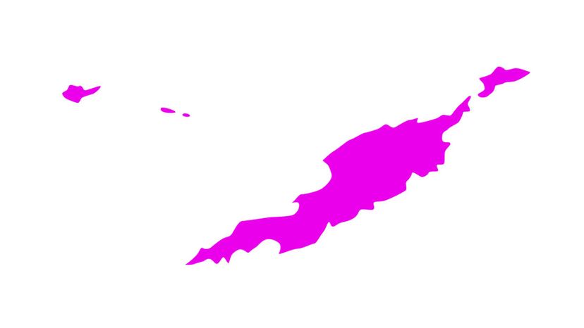
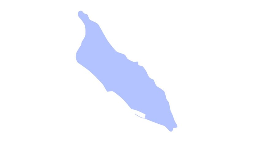
Which country's outline is shown in this image?
Aruba
United States Virgin Islands
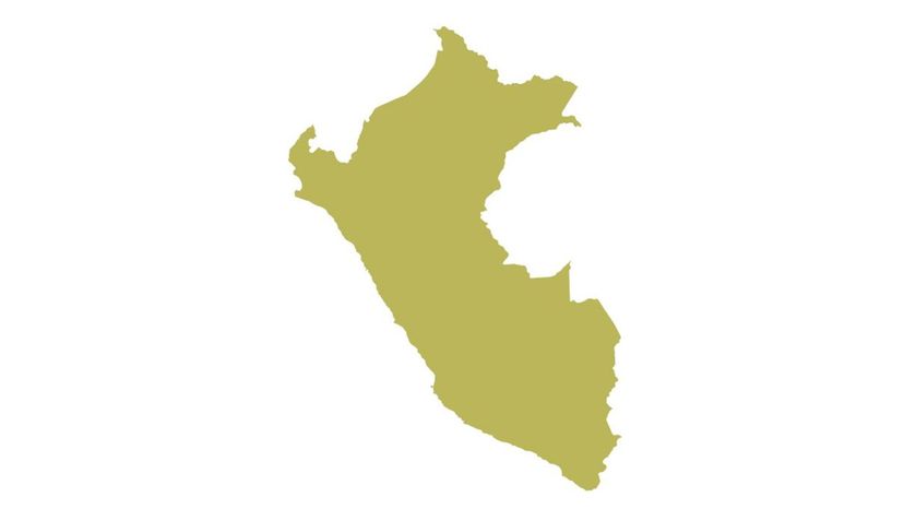
Peru
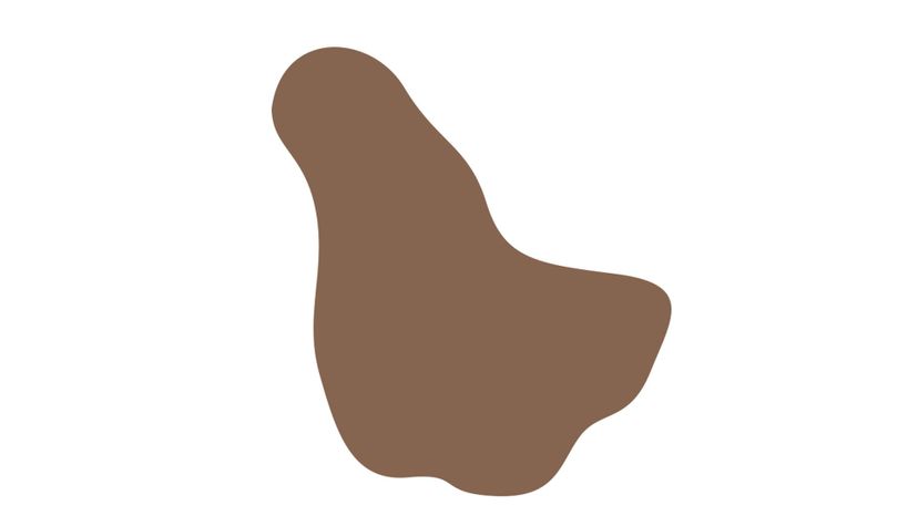
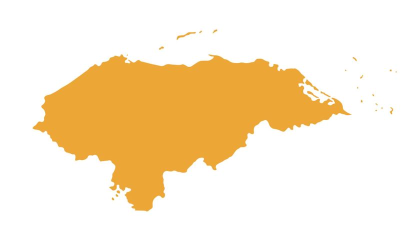
Honduras
The country of Honduras used to be called "Spanish Honduras.†This was done as a way to differentiate it from "British Honduras,†the former name of Belize (another Central American country).
Shutterstock
Which country's outline is shown in this image?
Bolivia
Saint Kitts and Nevis
The twin-island country of Saint Kitts and Nevis is located in the Lesser Antilles chain of islands. Saint Kitts and Nevis holds the distinction of being the Western Hemisphere's smallest sovereign state in terms of both population and area.
Jamaica
Nicaragua
Advertisement

Shutterstock
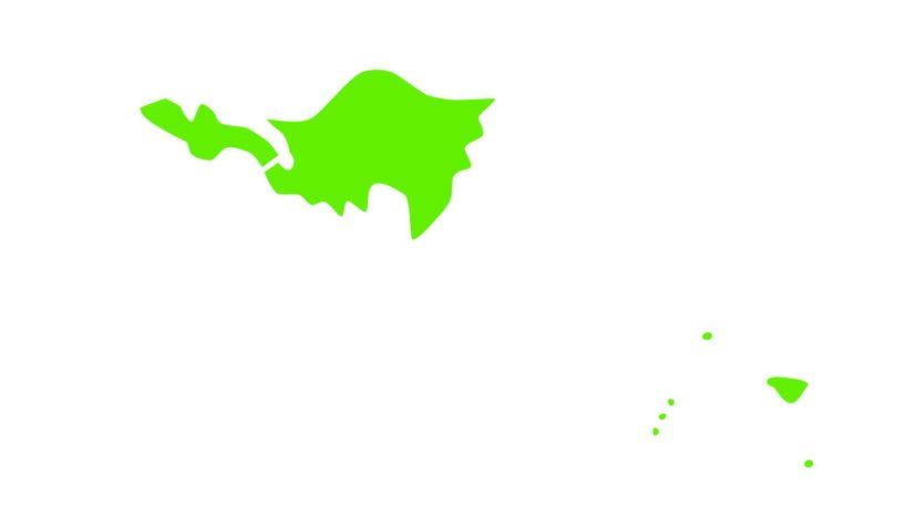
Which country's outline is shown in this image?
Haiti
Mexico
Colombia
Saint Vincent and the Grenadines
Saint Vincent and the Grenadines is often referred to as simply Saint Vincent and at other times as SVG. The country is made up of 32 islands and cays but is among the smallest in the Americas.
Shutterstock
Which country's outline is shown in this image?
British Virgin Islands
Canada
Anguilla
Anguilla is a British overseas territory. On September 7, 2017, the island was hit by Hurricane Irma, a Category 5 storm. Infrastructure on the island suffered severe damage.
Puerto Rico
Shutterstock
Which country's outline is shown in this image?
Grenada
Venezuela
Costa Rica
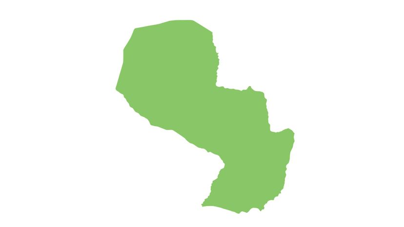
Paraguay
Paraguay, a landlocked country in South America, is often referred to as the "Heart of South America.†It is the smaller of the only two landlocked countries in the Americas. The other is Bolivia.
Advertisement
n/a
Which country's outline is shown in this image?
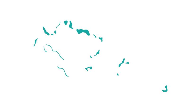
Turks and Caicos Islands
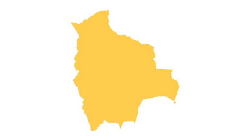
Bolivia
There are only two landlocked countries in the Americas - Bolivia and its smaller neighbor, Paraguay. The country is named after Simón Bolívar, one of the leaders in the Bolivian War of Independence in the early 19th century.
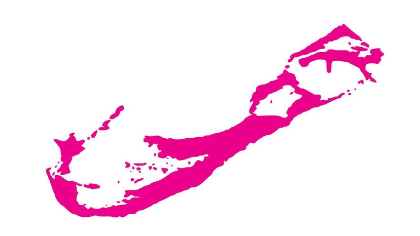
Bermuda
Ecuador
Shutterstock
Which country's outline is shown in this image?
Puerto Rico
Falkland Islands
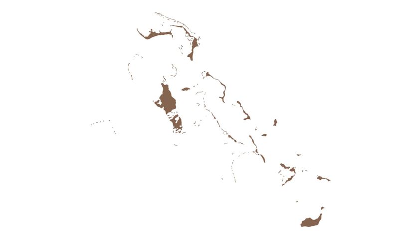
Bahamas
Saint Martin
Saint Martin (an overseas territory of France) occupies 60 percent of the island of Saint Martin, while the Dutch overseas territory of Sint Maarten occupies the remainder. The island was severely damaged by Hurricane Irma, a Category 5 storm, on September 7, 2017.
Shutterstock
Which country's outline is shown in this image?
Cayman Islands
Saint Lucia
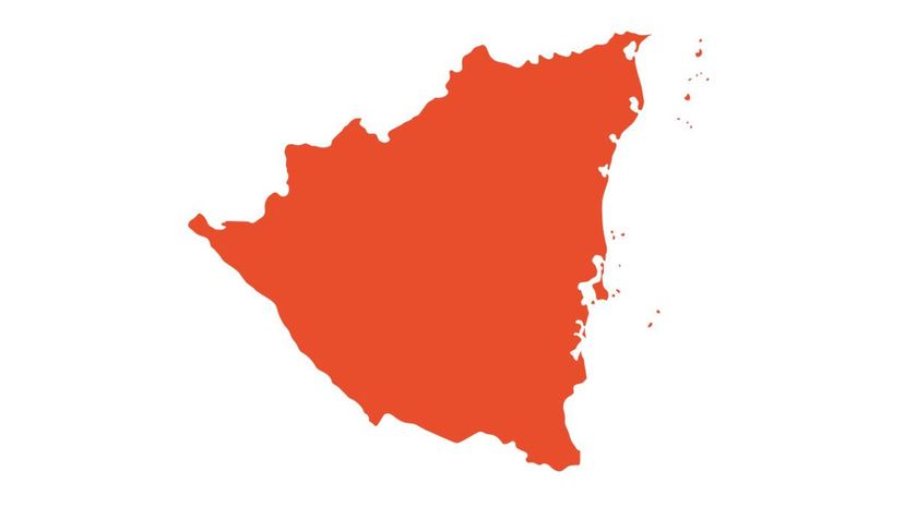
Nicaragua
Nicaragua is the largest of the seven countries that make up Central America. There are over 40 volcanoes (many still listed as active) in western Nicaragua.
Brazil
Advertisement
Shutterstock
Which country's outline is shown in this image?
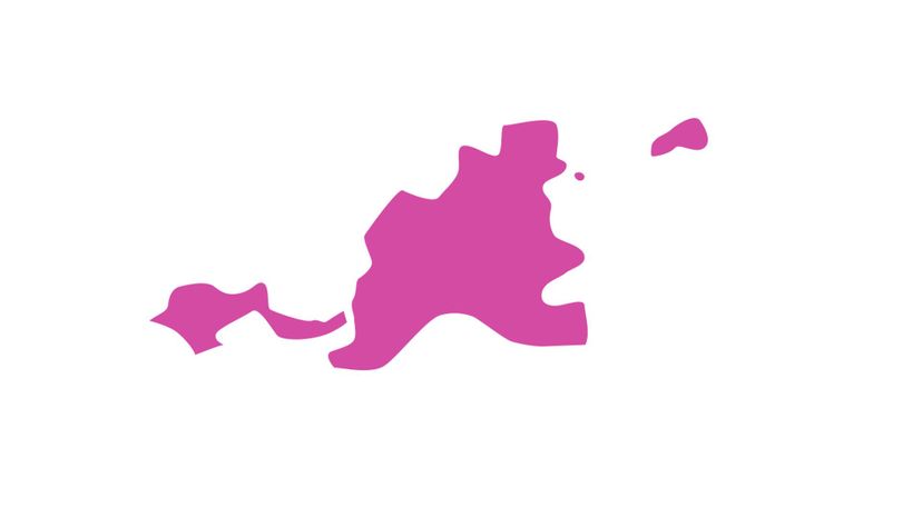
Sint Maarten
Sint Maarten is a constituent country of the Kingdom of the Netherlands. It shares the island of Saint Martin with the French overseas territory known as Saint Martin.
Chile
Suriname
British Virgin Islands
n/a
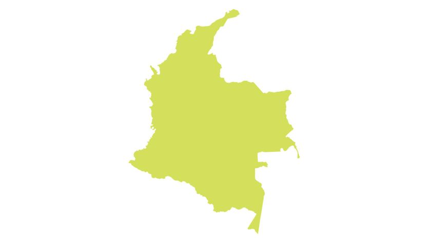
Which country's outline is shown in this image?
Colombia
Montserrat
Grenada
Haiti
Haiti is located on the western three-eighths of the island of Hispaniola. The rest of Hispaniola is occupied by the Dominican Republic. On January 1, 1804, Haiti became the first independent nation in Latin America and the Caribbean.
Shutterstock
Which country's outline is shown in this image?
Aruba
Aruba is a constituent country of the Kingdom of the Netherlands. The ABC islands, Aruba, Bonaire and Curacao, are the western-most islands of the Leeward Antilles.
Panama
Uruguay
Peru
Advertisement
Shutterstock
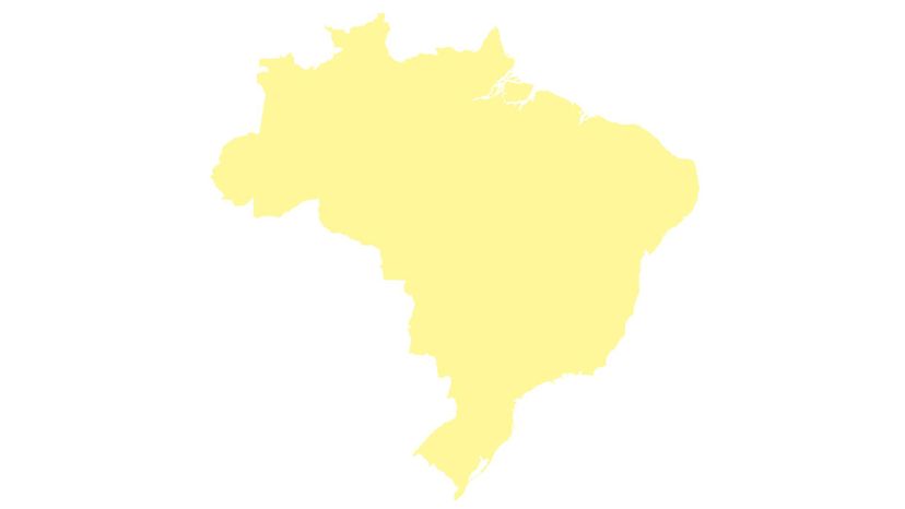
Which country's outline is shown in this image?
Brazil
c
El Salvador is Central America's smallest and most densely populated country. It became an independent nation on February 18, 1841. Its capital, San Salvador, was founded in 1525.
Cuba
Curacao
Shutterstock
Which country's outline is shown in this image?
Turks and Caicos Islands
The Turks and Caicos Islands, often referred to simply as TCI, is a British overseas territory made up of over 300 islands. The islands in the Turks Islands are generally smaller than those in the Caicos Islands chain.
Costa Rica
Bermuda
Canada
n/a
Which country's outline is shown in this image?
Trinidad and Tobago
Argentina
Brazil
The country is named for the brazilwood tree which once flourished along the coast. The wood is prized for making bows for stringed instruments. A deep red dye made from the tree was a major export in colonial times.
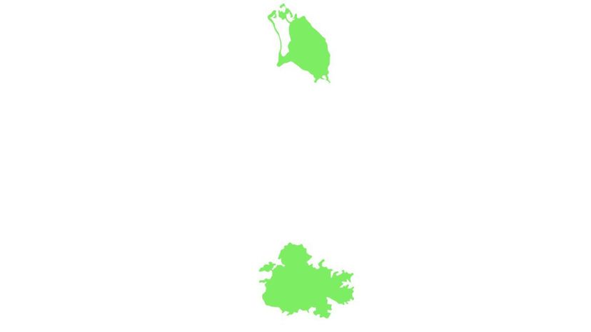
Antigua and Barbuda
Advertisement
Shutterstock
Which country's outline is shown in this image?
Paraguay
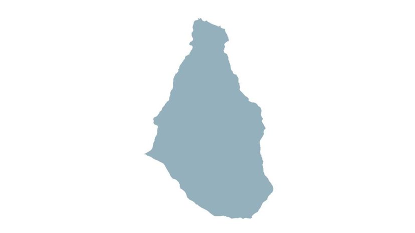
Montserrat
Montserrat is a British overseas territory in the Leeward Islands. In July 1995, the capital, Plymouth, was buried by over 39 feet of mud when the long-dormant Soufrière Hills volcano erupted.
Barbados
Venezuela
Shutterstock
Which country's outline is shown in this image?
Belize
Colombia
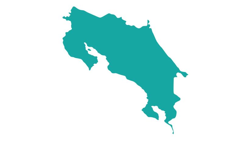
Costa Rica
Lake Arenal, in the northern highlands of Costa Rica, is the largest lake in the country. The original town of Arenal was left sitting at the bottom of the lake when it was expanded in 1979. The new town is located close by on higher ground.
Bolivia
n/a
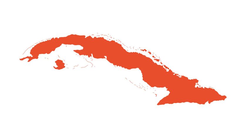
Which country's outline is shown in this image?
Bermuda
Cuba
Cuba is located at the intersection of three major bodies of water: The Atlantic Ocean, the Caribbean Sea and the Gulf of Mexico.
Bahamas
Martinique
Advertisement
Shutterstock
Which country's outline is shown in this image?
Curacao
Trinidad and Tobago
Guyana
British Virgin Islands
The British Virgin Islands, often referred to as BVI, is a British overseas territory. Only approximately 15 of the over 50 islands that make up the British Virgin Islands are inhabited.
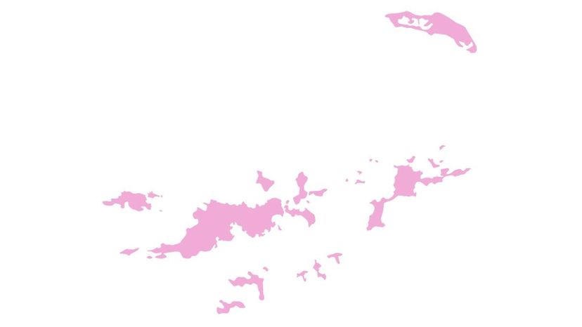
n/a
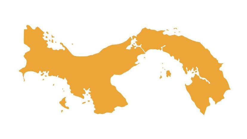
Which country's outline is shown in this image?
United States Virgin Islands
Panama
The 48-mile-long Panama Canal is an artificial waterway connecting the Atlantic and Pacific Oceans. Without this shortcut, vessels would have to travel around Cape Horn at the southernmost tip of South America - a much longer and much more dangerous journey.
Peru
Chile

Shutterstock
Which country's outline is shown in this image?
Anguilla
Puerto Rico
Uruguay
Cayman Islands
The Cayman Islands is an autonomous British overseas territory. The country is made up of the islands of Grand Cayman, Cayman Brac and Little Cayman.
Advertisement
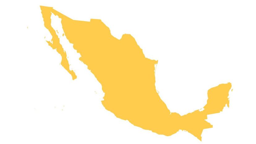
Shutterstock
Which country's outline is shown in this image?
Argentina
Bolivia
Mexico
The country's official name is the United Mexican States. In terms of area, Mexico ranks sixth largest in the Americas. Only Canada, the U.S., Brazil, Argentina and Greenland (in that order) are larger.
Antigua and Barbuda

Shutterstock
Which country's outline is shown in this image?
Grenada
Grenada is popularly known as the "Spice Isle†as it is a major producer of several spices, including allspice, cinnamon, nutmeg and mace. Only Indonesia produces more nutmeg than Grenada.
Saint Martin
Belize
Saint Kitts and Nevis
Shutterstock
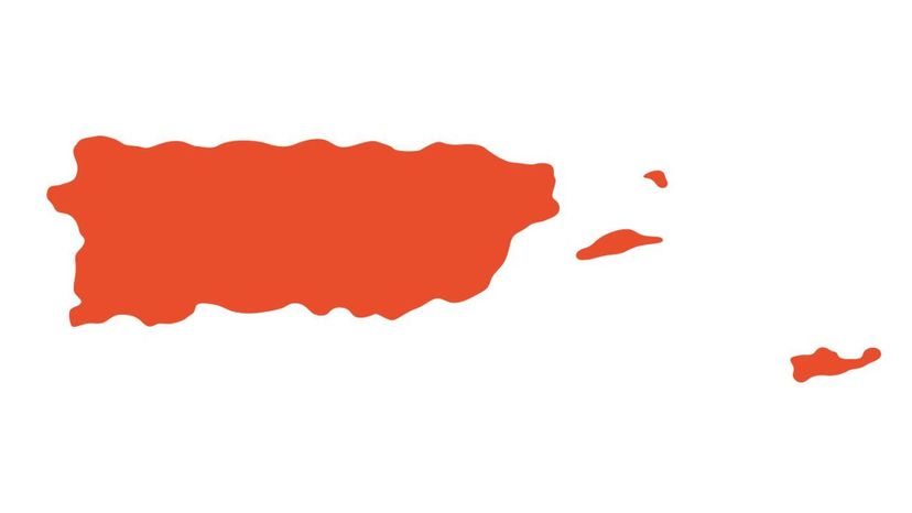
Which country's outline is shown in this image?
Puerto Rico
Puerto Rico is an unincorporated territory of the United States. Apart from the larger main island of Puerto Rico, there are several smaller islands of which only two are inhabited year-round. Puerto Rico was severely damaged when the eye of Hurricane Maria, a category 4 storm, made landfall on Sept. 20, 2017.
Saint Vincent and the Grenadines
Martinique
Aruba
Advertisement
Shutterstock
Which country's outline is shown in this image?
Greenland
Curacao
Cuba
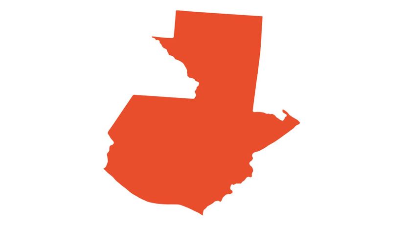
Guatemala
Guatemala is the most populated of the Central American countries. The heart of the Maya civilization was located in the region that is now Guatemala.
Shutterstock
Which country's outline is shown in this image?
Saint Lucia
El Salvador
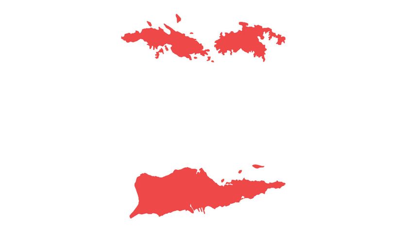
United States Virgin Islands
The United States Virgin Islands were once known as the Danish West Indies of the Kingdom of Denmark-Norway. The name was changed when the islands were sold to the United States in 1917.
Panama
Shutterstock
Which country's outline is shown in this image?
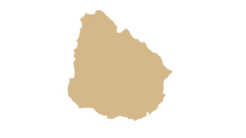
Uruguay
The country is officially known as the Oriental Republic of Uruguay. It is South America's second-smallest country in terms of area. Only Suriname is smaller.
Nicaragua
Dominican Republic
Suriname
Advertisement
Shutterstock
Which country's outline is shown in this image?
Falkland Islands
Saint Vincent and the Grenadines
Cayman Islands
Colombia
Colombia is ranked as a megadiverse country in terms of biodiversity. It is second on the list, with only Brazil ranking higher. Columbia, however, ranks first in terms of the number of bird species.
Shutterstock
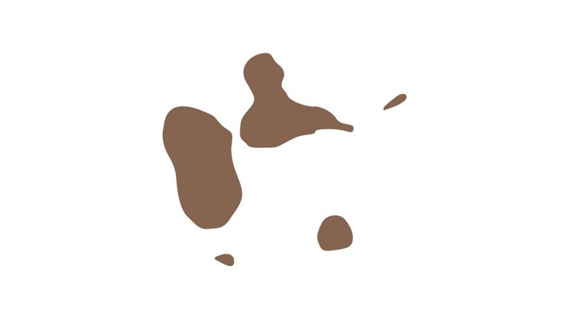
Which country's outline is shown in this image?
United States of America
Guadeloupe
The two main islands that make up Guadeloupe are Basse-Terre and Grande-Terre. They are separated by a narrow strait called the Salt River, or Riviere Salée, which is crossed by bridges.
Sint Maarten
Guyana
Shutterstock
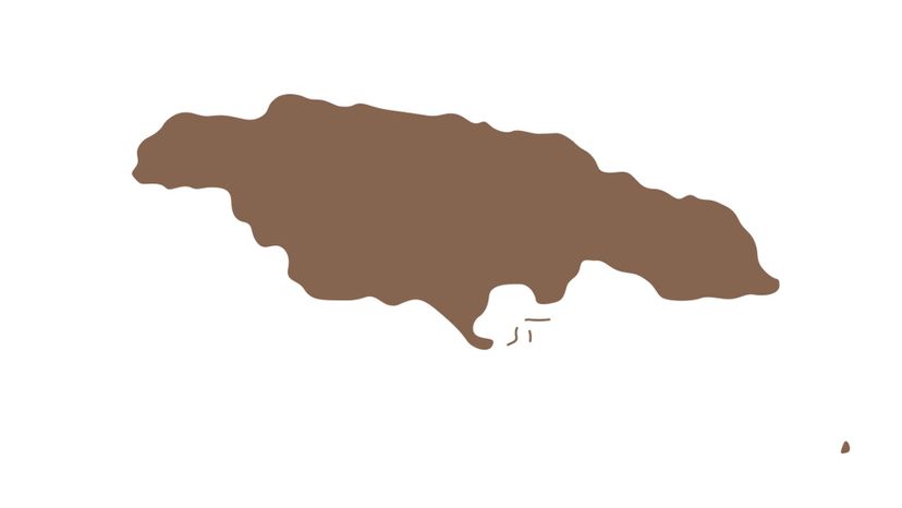
Which country's outline is shown in this image?
Jamaica
Jamaica has the third-largest population of all the English-speaking countries in the Americas. Only the U.S. and Canada are more populated. Although Jamaica has a hot, humid, tropical climate, its bobsled team performed creditably well during several Winter Olympics.
Honduras
Bahamas
Barbados
Advertisement
Shutterstock
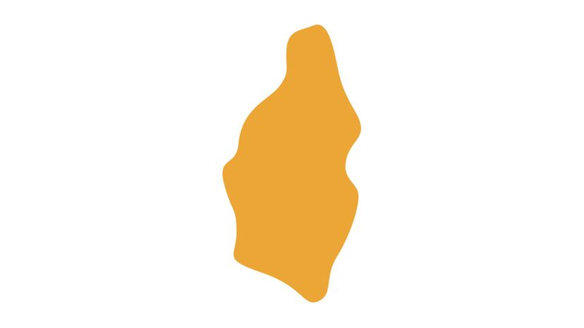
Which country's outline is shown in this image?
Venezuela
Saint Lucia
Saint Lucia, in the Windward Islands, is the only country in the world named after a woman. She was a young Italian Christian martyr named Saint Lucy of Syracuse.
Brazil
Paraguay
Shutterstock
Which country's outline is shown in this image?
Canada
Grenada
Saint Martin
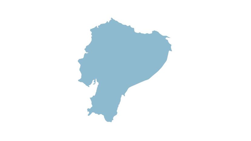
Ecuador
Ecuador's name comes from the fact that it is crossed by the equator. It is the westernmost country where this happens. The Galápagos Islands are owned by Ecuador, helping to make it one of the world's 17 megadiverse countries.
Shutterstock
Which country's outline is shown in this image?
Mexico
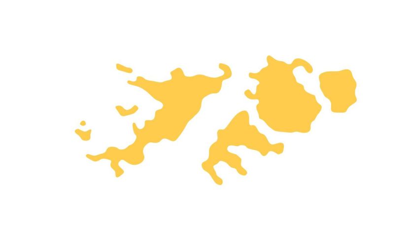
Falkland Islands
The Falkland Islands is a British overseas territory located at the southern tip of South America. It is an archipelago made up of approximately 780 islands.
Jamaica
Greenland
Advertisement
Shutterstock
Which country's outline is shown in this image?
Turks and Caicos Islands
Haiti
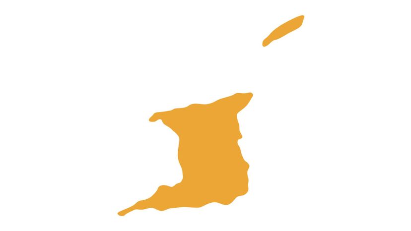
Trinidad and Tobago
The twin-island country of Trinidad and Tobago lies just off the South American coast. Geologically it is considered to be a part of that continent. The country is known as the Land of the Hummingbird.
Honduras
n/a
Which country's outline is shown in this image?
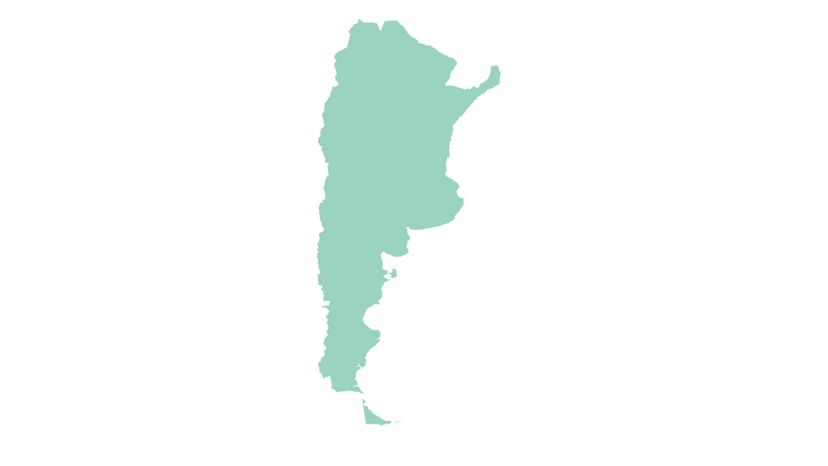
Argentina
Argentina ranks as the eighth-largest country in the world. Within Latin America, it is second-largest after Brazil. Among the Spanish-speaking ones, however, it is the largest.
Guadeloupe
Saint Kitts and Nevis
Costa Rica
Shutterstock
Which country's outline is shown in this image?
Montserrat
Guatemala
Martinique
Martinique is described as an insular region of France. It is a member of the European Union and uses the euro as its official currency.
Dominican Republic
Advertisement
n/a
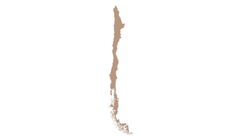
Which country's outline is shown in this image?
Chile
When the United Nations was established in 1945, Chile was one of its founding members. In English, the country's name used to be spelled "Chili."
British Virgin Islands
Anguilla
United States of America
Shutterstock
Which country's outline is shown in this image?
Mexico
Ecuador
Haiti
Curacao
Curacao is a constituent country of the Kingdom of the Netherlands. The capital, Willemstad, has many historic buildings and has been designated as a UNESCO World Heritage Site.
n/a
Which country's outline is shown in this image?
United States Virgin Islands
Guyana
Guyana is the fourth-smallest country on the South American mainland. It is the only country on the continent with English as its official language.
Dominican Republic
El Salvador
Advertisement
n/a
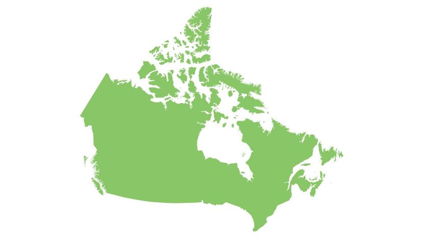
Which country's outline is shown in this image?
Canada
In terms of total area, Canada is the second-largest country in the world. It ranks fourth, however, in terms of land area. The border between Canada and the contiguous United States is the longest land border shared by any two countries in the world.
Martinique
Jamaica
Saint Martin
Shutterstock
Which country's outline is shown in this image?
Turks and Caicos Islands
Antigua and Barbuda
After Hurricane Irma passed over the twin-island country on September 7, 2017, approximately 95 percent of Barbuda's buildings and infrastructure were damaged or destroyed. The island's residents were then almost completely evacuated to Antigua.
Anguilla
Guatemala
Shutterstock
Which country's outline is shown in this image?
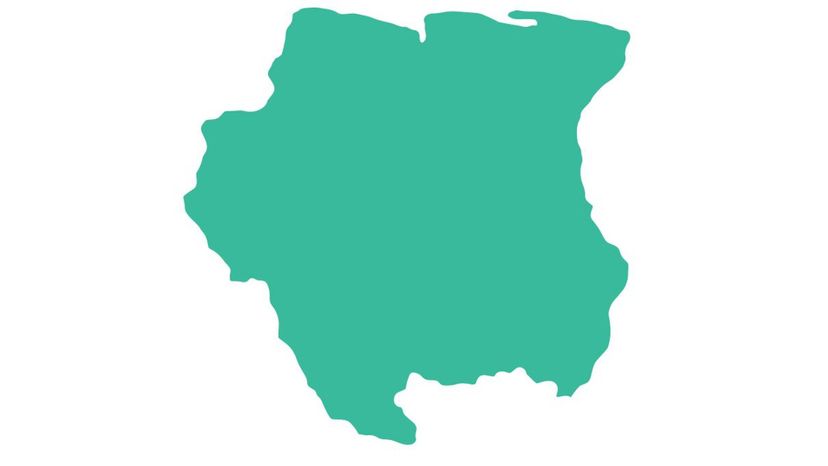
Suriname
Dutch is the official language of Suriname. It is the only non-European territory where the majority of the population speaks Dutch.
Honduras
Trinidad and Tobago
Sint Maarten
Advertisement
Shutterstock
Which country's outline is shown in this image?
Greenland
Guadeloupe
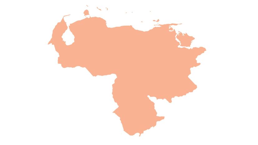
Venezuela
In the early part of the 20th century, oil was discovered in Venezuela. The country is currently a leading exporter of oil and holds the world's largest known oil reserves.
Aruba
Shutterstock
Which country's outline is shown in this image?
Suriname
Chile
Saint Vincent and the Grenadines
Belize
Belize was formerly known as British Honduras as a way to distinguish it from Spanish Honduras, which today is simply known as Honduras. In terms of population, Belize's capital, Belmopan, is the smallest capital city located in the continental Americas.
Shutterstock
Which country's outline is shown in this image?
Barbados
Argentina
Bermuda
The infamous Bermuda Triangle, where airplanes and ships are said to mysteriously disappear, has only one tip located in Bermuda. The Triangle extends from Miami to San Juan (Puerto Rico) and to Bermuda.
Paraguay
Advertisement
Shutterstock
Which country's outline is shown in this image?
Falkland Islands
Peru
Civilization in the region that is now Peru, dates back to 9000 BC. By the time Europeans arrived in the 15th century, the dominant people were the Incas who had created the largest empire in the Americas, with their capital in Cusco.
Cayman Islands
Saint Kitts and Nevis
Shutterstock
Which country's outline is shown in this image?
Bahamas
When Christopher Columbus arrived in the New World in 1492, The Bahamas was the first place he landed. This is commemorated on the country's coat of arms, which bears a picture of Columbus's ship, the Santa Maria.
Uruguay
United States of America
Nicaragua
You Got:
/50
Shutterstock