Do You Have Basic Map Skills?

By: Jacqueline Samaroo
Estimated Completion Time
4 min
Do You Have Basic Map Skills?
Image: n/a

About This Quiz

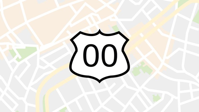
"Which way did he go, George? Which way did he go?" Does that sound like you, or are you ready to run this map all over town? When it comes to reading maps, do all roads lead to your destination? Or do you get sidetracked by some unknown signs?

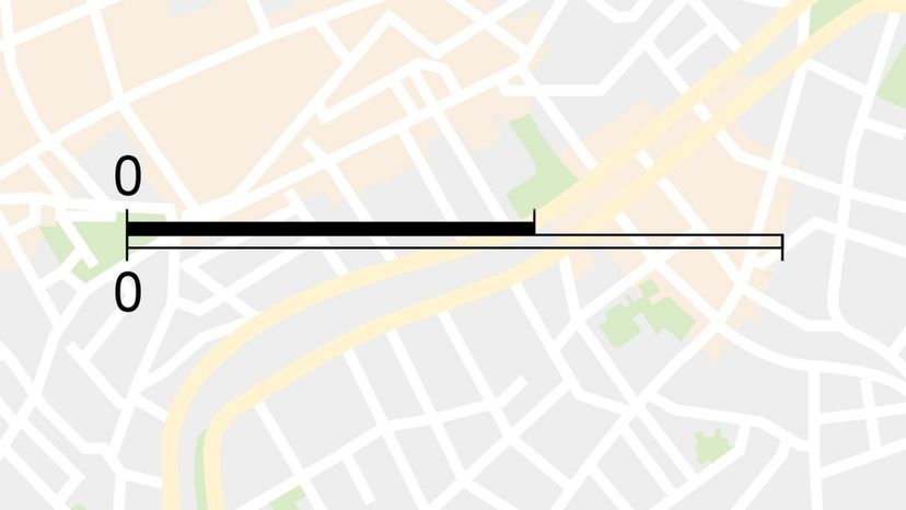
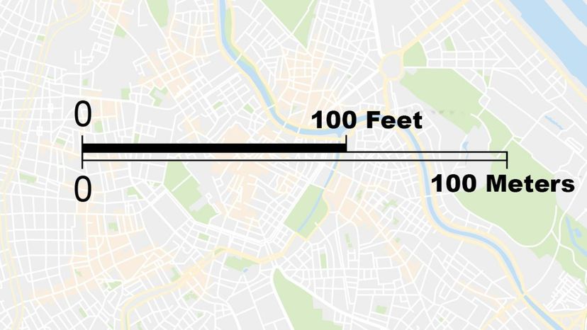
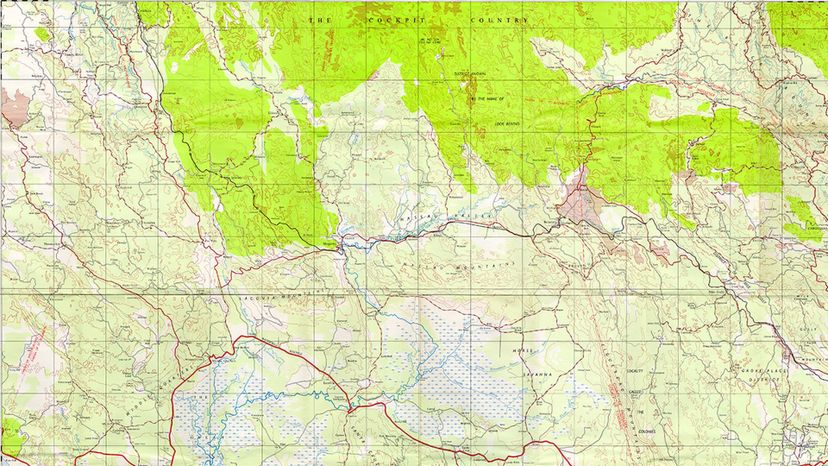
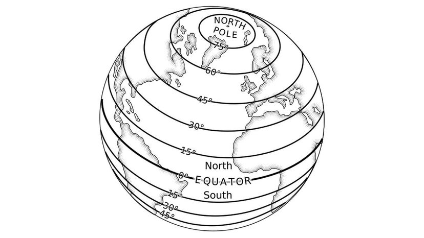
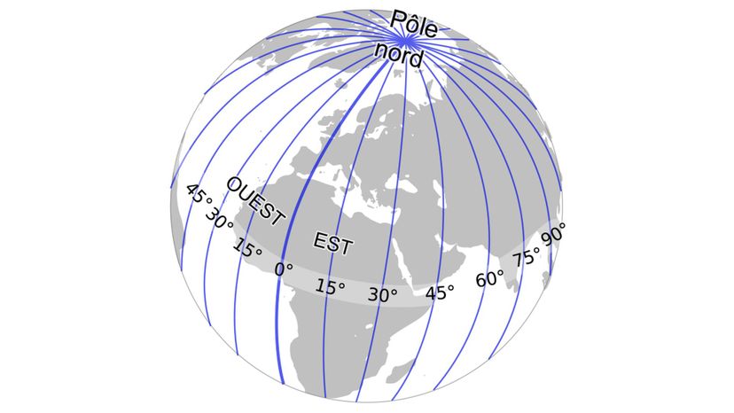
Reading a map is not just about the signs. It's also about the measurements. Depending on where you are in the United States, some people might refer to distance in well... distance, while others will tell you in time! "Excuse me, could you tell me where the post office is?" One person in New York might tell you, "It's three blocks away," while another person in Boston might say, "It's  five minutes down the road!" In other places, you're in such a remote area that you can't always guarantee there will be a person to ask, and your phone might not have any reception.

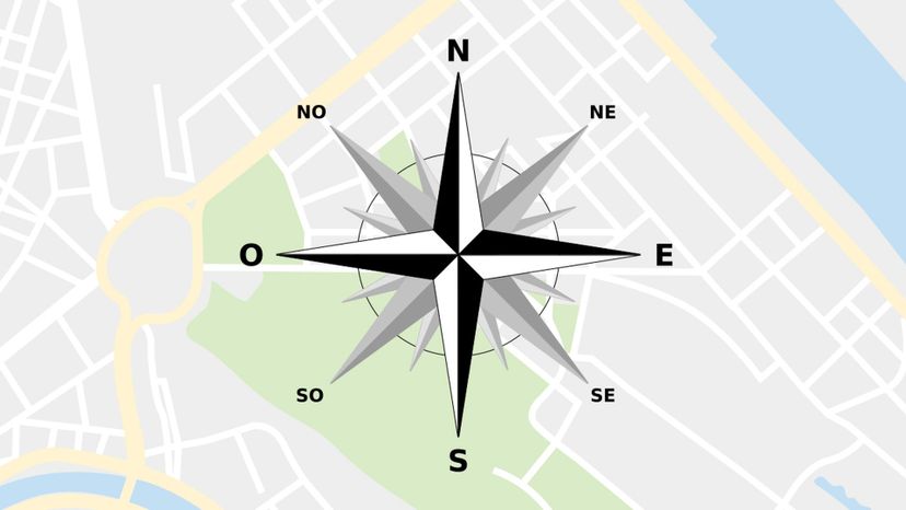
Ultimately there's no substitute for a physical map, and that means it's time to see how good your basic maps skills really are! This quiz will test whether they will  lead you home or leave you stranded on the side of the road, hoping to hitch a ride! Good luck and Godspeed!

Hospital
Wiki commons
What does the map symbol shown in this photo represent?
Orchard
Marsh/Swamp
Hospital
A white “H” on a blue background or a red cross on a white background are two of the typical symbols for a hospital. The red and white version is, however, mostly reserved for times or situations of conflict.
Swimming Area

Advertisement

Church
n/a
What does the map symbol shown in this photo represent?
Church
The cross (resembling +) is often used on Christian buildings. In times gone by the cross which was used more closely resembled the capital letter “T”.
Fishing
Highway
Dining/Restaurant

Advertisement

School
n/a
What does the map symbol shown in this photo represent?
Public Telephone
Intermittent Pond
School
There are many symbols used to represent educational institutions on a map. Among them are the abbreviation “SCH” and the image of the square academic cap typically worn by graduates.
Highway

Advertisement

Post office
Wiki commons
What does the map symbol shown in this photo represent?
Primary Roadway
Post Office
Post offices handle mail of all types, but are universally associated with envelopes This is why the closed face of an envelope is most often used to indicate a post office. Otherwise, the letters “PO” are also commonly used.
Intermittent River
Airport

Advertisement

Museum
Wiki commons
What does the map symbol shown in this photo represent?
Swimming Area
Museum
Museums have traditionally been grand buildings, a fact which helps to explain why a many-pillared building is often used in their symbol. Most times, a capital letter “M” is added to the center of the design.
Campground
Fishing

Advertisement

DiningRestaurant
Wiki commons
What does the map symbol shown in this photo represent?
Cemetery
Orchard
Windmill
Dining/Restaurant
Restaurants and other eating establishments are most often depicted with a knife and fork. There are some symbols which cross the two utensils and others which place them either on a plate or on opposite sides of one.

Advertisement

Swimming
Wiki commons
What does the map symbol shown in this photo represent?
Swimming area
There are some map symbols which indicate that the swimming area is specifically a pool. On these, we normally see a ladder leading into/out of the water.
School
Hospital
Bus station

Advertisement

Bathroom
Wiki commons
What does the map symbol shown in this photo represent?
Picnic area
Intermittent pond
Diving/Snorkeling area
Restroom
While the outlines of a male and female figure are commonly used to represent a restroom, there are a few other symbols. These include “PC” for “public convenience toilets” and “WC” for “water closet.”

Advertisement

Bus Station
Wiki commons
What does the map symbol shown in this photo represent?
Bus station
Both bus stations and bus stops are generally indicated by the outline of a bus. A bus stop symbol, however, may also include a vertical “bus stop sign” next to the bus.
Intermittent river
Diving/Snorkeling area
Windmill

Advertisement

Airport
Wiki commons
What does the map symbol shown in this photo represent?
Cemetery
Orchard
Fishing
Airport
The universally recognizable outline of an airplane is the symbol most often used for an airport. There are some maps which show the outline of a landing strip or runway.

Advertisement

Public Telephone
Wiki commons
What does the map symbol shown in this photo represent?
Museum
Airport
Public telephone
The symbol for the public telephone is typically a “receiver” or “handset” and is based on the traditional landline telephone. This is so even though landline telephone use is experiencing a steady decline caused by an increase in the use of both cellular and internet alternatives.
Church

Advertisement

Windmill
Wiki commons
What does the map symbol shown in this photo represent?
Restroom
Highway
Windmill
A single windmill is usually depicted by a single symbol on a map. A wind farm, on the other hand, is typically shown as two or more windmill symbols together.
Campground

Advertisement

Cemetery
n/a
What does the map symbol shown in this photo represent?
Bus station
School
Cemetery
There are several common ways to indicate the location of a cemetery on a map. They include the letters “CEM”, a cross and a cross atop a mound.
Primary roadway

Advertisement

Camping
Wiki commons
What does the map symbol shown in this photo represent?
Campground
Campground symbols are almost always a depiction of a tent. While some may look like a simple inverted “V”, others take on the appearance of a tepee outline.
Hospital
Post office
Airport

Advertisement

Picinic Area
Wiki commons
What does the map symbol shown in this photo represent?
Highway
Picnic area
Most picnic area symbols capture the basic shape of a picnic table. The shape is sometimes simplified to an “X” with a bar “__” across the top.
Bus station
Marsh/Swamp

Advertisement

Fishing
Wiki commons
What does the map symbol shown in this photo represent?
Fishing
Maps use several different symbols to identify an area designated for fishing. These include the outline of a fish; a fish on the end of a line; a fish alongside a line and hook; and a person casting a line.
Public telephone
Church
Cemetery

Advertisement

Diving Snorkeling area
Wiki commons
What does the map symbol shown in this photo represent?
School
Picnic area
Post office
Diving/Snorkeling area
While the two activities are not necessarily done together, they are often combined on maps. Scuba diving is frequently shown with the “SCUBA” abbreviation.

Advertisement

Marsh
Wiki commons
What does the map symbol shown in this photo represent?
Hospital
Dining/Restaurant
Primary roadway
Marsh/Swamp
The marsh symbol is a combination of symbols for both water and plants. There are different types of marsh symbols, such as those for a freshwater marsh, a salt marsh or a submerged marsh.

Advertisement

Primary Roads
n/a
What does the map symbol shown in this photo represent?
Swimming area
Public telephone
Primary roadway
The depiction of a roadway tends to change based on the scale of the map. Small scale maps which cover a large area will most likely only indicate major roads.
Orchard

Advertisement

Highway
Wiki commons
What does the map symbol shown in this photo represent?
Highway
There are a wide variety of highway symbols used on maps. Some show tunnels, overpasses and underpasses, as well as bridges and drawbridges.
Picnic area
Restroom
Windmill

Advertisement

Scale
Wiki commons
The map feature shown in the photo helps you to check distances between points on a map. What is it?
Legend
Scale
The scale is the ratio in which real-world elements have been scaled down on the map. It is possible for different sections of a map to be drawn to different scales.
Grid lines
Contour lines

Advertisement

Large scale
Wiki commons
Which scale would give the most details on the map shown?
Small scale
Medium scale
Large scale
Large scale maps show a smaller area in greater detail when compared to both medium and small scale maps. Interestingly, the smaller the number on the right hand side of the scale, the larger the scale is said to be.

Advertisement

1-10000 map
n/a
Which scale would give the most details on the map shown?
1:10,000
As the number on the right hand side of the scale increases some changes take place on the map. These include: it can show a larger area; and it shows less details. Typical maps of the world have scales in the region of 1: 50,000,000.
1: 20,000
1: 30,000
1: 40,000

Advertisement

1-50000 map
Wiki commons
The map scale shown in the photo is 1: 50,000. What does 1 cm on the map represent on the actual land?
50,000 km
50,000 cm
Both numbers on the scale are in the same units, in this case that is cm. For practical reasons, someone using the map may need to convert to a larger unit, so in this case it is 1 cm to 0.5 km. Some scales carry the conversion to make it easier for the map reader.
50,000 m
50,000 miles

Advertisement

Compass Rose
Wiki commons
Which map feature is shown in this photo?
Grid lines
Key
Compass rose
Civilizations have routinely come up with ways to denote different directions. Predominant among them are the use of the directions in which the sun rises (east) and sets (west), as well the location of celestial bodies in the night sky.
Legend

Advertisement

South
Wiki commons
Which direction is indicated by the X on this compass rose?
Northeast
West
South
The geographic, terrestrial or true south pole is a located in Antarctica. The magnetic south pole is, however, currently located off the coast of Antarctica. At the present time, the two souths are more than 1,700 miles apart.
East

Advertisement

North East
Wiki commons
Which direction is indicated by the X on this compass rose?
West
Northeast
Northeast is the direction midway between north and east. Its direct opposite is southwest.
South
East

Advertisement

West
Wiki commons
Which direction is indicated by the X on this compass rose?
North
South
Southeast
West
On Earth, west is the direction in which the sun sets. It is perhaps for this reason that several ancient civilizations associate the west with death and the afterlife.

Advertisement

Southwest
n/a
Which direction is indicated by the X on this compass rose?
Southwest
Southwest is the direction midway between south and west. It is the direct opposite of northeast.
North
East
South

Advertisement

East
Wiki commons
Which direction is indicated by the X on this compass rose?
South
North
Southwest
East
On Earth, east is the direction in which the sun rises. It is one of the four cardinals point - the others being north, south and west.

Advertisement

North
Wiki commons
Which direction is indicated by the X on this compass rose?
Southeast
West
South
North
A compass needle points to the magnetic north. This is a different location from the position of geographic or true north.

Advertisement

South Southwest
Wiki commons
Which direction is indicated by the X on this compass rose?
East
South-Southwest
South-southwest is one of the points indicated on a 16-point compass rose. For compass roses with 32 points, south-by-west and southwest-by-south are on either side of south-southwest.
North
West

Advertisement

Grid Lines
Wiki commons
The lines on this map divide it into squares so places can be easily located. What are they called?
Great circle
Large scale
Grid lines
The use of grid lines to locate places on a map is called grid reference. Common types are 4-figure and 6-figure grid reference, with 6-figure grid reference giving a more precise location.
Equator

Advertisement

Isotherms
Wiki commons
The lines on this map join points of equal temperature. What are they called?
Isotherms
Isotherms are a common feature on maps used by meteorologists. Following on the universally accepted convention, blues are usually used for the coldest temperatures and reds for the hottest.
Highway
Climatic map
Great circle

Advertisement

Contour Lines
Wiki commons
The lines on this map join points of equal height. What are they called?
Contour lines
Contour lines can help you to visualize the shape of the land. To make maps less cluttered and easier to read, contour lines are normally not used all over but only for certain elevations or depressions.
International Date Line
Topographical map
Compass Rose

Advertisement

Isobars
Wiki commons
The lines on this map join points of equal atmospheric pressure. What are they called?
Isobars
A map which shows isobars will most likely also display capital “L” for areas with the lowest pressure and capital “H” for places with the highest pressure.
Political map
Prime meridian
West

Advertisement

Physical Map
Wiki commons
What type of map is shown in this image?
Grid lines
Campground
Physical map
A physical map is normally shaded in blues, greens and browns to represent, mountains, valleys, plains, wooded areas, waterways and water bodies. All of these features are typically labeled on a physical map.
Lines of longitude

Advertisement

Resource Map
Wiki commons
What type of map is shown in this image?
Museum
Resource map
These maps will show both natural resources and economic activities within an area. Abbreviations or easily recognizable symbols are usually used on resource maps.
Equator
Great circle

Advertisement

Political Map
Wiki commons
What type of map is shown in this image?
Contour lines
Prime Meridian
Political map
Political maps are usually brightly colored and show boundaries between and within countries. For example, a political map of Europe will show the separation of the different countries, while the section representing England will show the separation of the counties.
Post office

Advertisement

Climatic Map
Wiki commons
What type of map is shown in this image?
Lines of longitude
Swimming area
International Date Line
Climatic map
A climatic map shows the prevailing weather patterns experienced in a certain area. A climatic map is typically a conventional map, such as a physical map with the climatic information superimposed on it in bright colors.

Advertisement

Topographical Map
Wiki commons
What type of map is shown in this image?
Diving/Snorkeling Area
Topographical map
A topographical map is very much like a physical map. The main differences tend to be that it uses less colors but more contour lines to show the relief of the land.
Great circle
Lines of latitude

Advertisement

Equator
Wiki commons
It's the imaginary line in this photo divides the Earth into Northern and Southern Hemispheres. What is it called?
Political map
Intermittent pond
Scale
Equator
The equator is a great circle since it divides the Earth into two hemispheres. It is a special great circle because it is equidistant from both the north and south poles, and thus has 0 degrees latitude. The closer you are to the equator, the quicker both sunrise and sunset will appear to be.

Advertisement

Prime Maridian
Wiki commons
This imaginary line divides the Earth into Eastern and Western hemispheres. What is it called?
Prime Meridian
Greenwich Meridian (or the meridian through the Royal Observatory, Greenwich, United Kingdom) is generally accepted as the international prime meridian. The antemeridian of Greenwich is the 180 degrees meridian, along which the International Date Line is formed.
Resource map
Intermittent pond
Northeast

Advertisement

Lines of Latitude
Wiki commons
The imaginary lines in this photo circle the Earth from east to west. What are they called?
Lines of latitude
The equator is one of the major lines of latitude. The others are Arctic Circle and the Tropic of Cancer (both to the north of the Equator) and the Tropic of Capricorn and the Antarctic Circle (both to the south of the Equator.
Primary roadway
Isotherms
South-Southeast

Advertisement

Lines of Longitude
Wiki commons
The imaginary lines in this photo go from North Pole to South Pole. What are they called?
West
Highway
Lines of longitude
While each and every line of latitude circles the Earth, it takes two lines of longitude (or meridians) to complete one circle around the globe. However, whereas the equator is only line of latitude that is also a great circle, the circles formed by pairs of lines of longitude are all great circles.
Isobars

Advertisement

International Date Line
n/a
Crossing the imaginary line in this photo causes you to either lose or gain a day. What is it called?)
International Date Line
The International Date Line only roughly follows the 180 degrees meridian. It zig-zags to avoid some territories having two separate calendar days at the same time.
Compass Rose
Large scale
East

Advertisement

Great Circle
Wiki commons
Imaginary lines like the one in this photo divide the Earth into hemispheres. What are these lines called?
Great circles
It is often said that a straight line is the shortest distance between two points. When it comes to navigation, however, the shortest distance between any two points on Earth (a sphere) is actually achieved by following the path of a great circle.
Climatic map
Scale
North

Advertisement

You Got:
/47
n/a